Melbourne waterway walks
Explore rivers, creeks and wetlands by foot
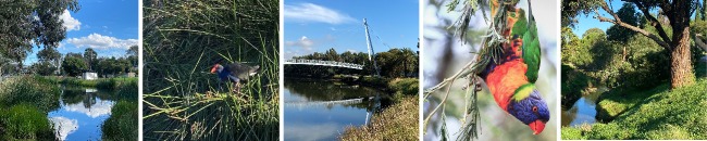
When it comes to urban walks in nature, Melbourne has plenty of fantastic waterways to explore.
Victoria Walks has worked in partnership with Melbourne Water to map walks along Melbourne's waterways.
The walks below highlight the best of Melbourne's river, creek and wetland walks, from Werribee River in the west to Darebin Creek in the north.
| Jump to: |
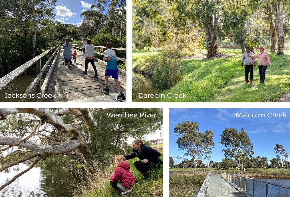
Darebin Creek
1. Darebin Creek Trail day hike, Alphington to Bundoora, 9 km end to end
A terrific hike along Darebin Creek through Darebin Parklands and urban bush settings. This walk is public transport accessible, starting at Alphington Station and finishing at the 86 tram on Plenty Road, Bundoora.
2. Darebin Creek from Darebin Parkland to the Yarra River, Alphington to Kew, 2.5 km (5km return)
This walk follows the Darebin Creek Trail from the urban bushland oasis of Darebin Parklands, through a series of reserves before reaching the confluence of the Yarra River.
3. Epping waterway loop, Darebin Creek and Findons Creek, Epping, 5 km loop
This walk takes in a picturesque section of Darebin Creek in Epping and then follows Findon Creek to create an interesting and varied loop.
Moonee Ponds Creek
1. Woodlands Historic Park, Moonee Ponds Creek, Greenvale, 3.8 km loop
Stretch your legs in bushland at Woodlands Historic Park. This walk has kangaroos, abundant birdlife and ancient River Red Gums along the upper reaches of Moonee Ponds Creek.
2. Moonee Ponds Creek, Strathmore, 2.7 km one way, 5.4 km return
A great walk along a lovely, semi-natural section of the Moonee Ponds Creek Trail winding through undulating landscapes and varied native vegetation.
Westbreen Creek
Westbreen Creek Walk, Pascoe Vale, 2.25 km loop
Pascoe Vale has a lovely slice of bushland along the Westbreen Creek corridor. It's a great place for a tranquil walk in nature.
Edwardes Creek
Edwardes Lake and Edwardes Creek Wetlands 3.6 km loop
This walk takes a circuit around the beautifully kept parklands of Edwardes Lake, then onto Edwardes Creek wetlands. The lake circuit is flat and accessible - see Edwardes Lake Park accessible walk.
Malcolm Creek
1. Malcolm Creek Wetlands, Craigieburn (5.5 km loop)
Malcolm Creek and its linear parklands provide a wonderful green corridor through Craigieburn. Highlights of this walk include ancient River Redgums, boardwalks, tranquil scenery and a tribute and marker for the Stolen Generations.
2. Golden sun moth walk, Malcolm Creek (1.7 km)
Golden Sun Moth Walk has two playgrounds, Malcolm Creek wetlands and important habitat for the threatened moth species.
Jacksons Creek
The Nook, Jacksons Creek, Sunbury, 1.46 km or 3 km return.
Jacksons Creek waterhole, also known as the Nook, is a very picturesque spot located on a bend in Jacksons Creek. The surrounding parkland and walking paths are great to explore.
Organ Pipes National Park, Keilor North, 3.2 km loop
A short walk along Jacksons Creek in a small national park named after the volcanic rock formations that resemble organ pipes. The creek is a lovely shady place to walk and explore. Note - this is not an accessible walk.
Taylors Creek
Taylors Creek lakeside loop, Taylors Lakes, 3.4 km loop
This is a great circuit around the scenic lakes and wetlands of Taylors Creek. Popular with families, joggers and people enjoying picnics and time outdoors.
Maribyrnong River
Maribyrnong River Loop, Moonee Ponds
This popular 4 km circuit around the mighty Maribyrnong River passes through Moonee Ponds, Aberfledie and Maribyrnong.
Kororoit Creek
Kororoit Creek Trail, Albion to Sunshine West, 5 km each way, 10 km return
A gem of a walk along Kororoit Creek. Highlights include extensive revegetation of local flora, basalt outcrops and boulders, and birdlife.
Skeleton Waterholes Creek
1. Skeleton Creek from grasslands to wetlands, 7 km loop
A fantastic loop walk on the Skeleton Creek Trail from Emu-Foot Grassland, a reserve of significant local flora, to Cheetham Wetlands, a haven for shore birds and water birds.
2. Skeleton Waterholes Creek, Truganina and Tarneit, 5 km loop
A varied and interesting wander along Skeleton Waterholes Creek and Tarneit Creek. With wide-open space and wetland habitats, this walk is excellent for connecting to nature in Melbourne's west.
3. Day hike in the west, Altona Meadows to Williamstown
A fantastic 22 km walk taking in creeks and wetlands that feed into Port Philip Bay. This walk links Skeleton Creek to Bay Trail West, past Laverton, Cherry and Kororoit Creeks to Williamstown Beach. Public transport accessible!
Laverton Creek
1. Truganina Park Trail and Laverton Creek Spit, Altona 4 km loop
Truganina Park is a bird watcher's paradise and a great place to walk through coastal parkland. This trail starts and finishes at Altona Foreshore, crosses Laverton Creek and loops around Truganina Park.
2. Altona Skipper Butterfly Loop, Truganina Park, Altona Meadows, 2.3 km loop
Walk up the "100 Steps to Federation" hill for the best views in the west. On a clear day, you can see the CBD, ships on Port Philip Bay, Cheetham Wetlands and the You Yangs in the distance. This circuit walk on the Truganina Park Trail takes in habitats for endangered species including the Swift Parrot and Altona Skipper Butterfly.
Lollypop Creek
Lollypop Creek Trail, Wyndham Vale, 4.4 km loop
A series of elevated boardwalks open this 4.4km loop walk allowing you to get up close to the rehabilitated wetlands. The Lollypop Creek Trail leads to the spectacular and serene Tucker's Waterhole.
Werribee River
1. Riverbend Park to Davis Creek, Tarneit, 3 km each way
Wander along Werribee River to the wetlands and billabongs of Davis Creek. River redgums, birdlife and croaking frogs make this a wonderful walk to connect to nature.
2. Wyndham Park loop, 2.6 km loop
Explore Wyndham Park and the Werribee River in the heart of Werribee's CBD. Platypus have been sighted in all sections of the Werribee River, including this section of the river, right in town. Wyndham Park has been updated with fantastic new playgrounds and is a destination in its own right.
3. Werribee to Riverbend Park loop , 8.2 km loop
A fantastic loop along the Werribee River that feels more like the countryside than the urban fringes. Highlights include ancient River Redgums, tranquil river scenery, market gardens and historical markers.
4. Urban hike along the Werribee River
Stretch your legs along 8.5 km of continuous riverside pathways in central Werribee (17 km return).
5. Werribee River Park, Cocoroc
2.6 km loop taking in escarpment views, the historic bluestone ford and peaceful red gum bushland. Werribee Park Lake Accessible Walk and State Rose Garden Accessible Walk are close to this walk.
6. K Road Cliffs, Werribee South, 600m return
A short but spectacular walk to view the dramatic red cliffs over the Werribee River. A haven for waterbirds and photographers!
7. Wyndham Bay Trail to Werribee South Foreshore 2.5 km one way, 5 km return
Coastal wetlands and river estuaries
1. Truganina Park Trail and Laverton Creek Spit, Altona 4 km loop
Truganina Park is a bird watcher's paradise and a great place to walk through coastal parkland. This trail starts and finishes at Altona Foreshore, crosses Laverton Creek and loops around Truganina Park.
2. Altona Skipper Butterfly Loop, Truganina Park, Altona Meadows, 2.3 km loop
Walk up the "100 Steps to Federation" hill for the best views in the west. On a clear day, you can see the CBD, ships on Port Philip Bay, Cheetham Wetlands and the You Yangs in the distance. This circuit walk on the Truganina Park Trail takes in habitats for rare species including Swift Parrot and Altona Skipper Butterfly.
3 Cheetham Wetlands, Point Cook, 3 km loop
Explore the wetlands and salt marshes from the boardwalks and observation tower at Cheetham Wetlands in Point Cook. This expansive park is important for migratory shorebirds that visit Port Phillip Bay from the northern hemisphere.
4 Wyndham Bay Trail to Werribee South Foreshore 2.5 km one way, 5 km return
Take a seaside stroll along the less-explored coastline of Port Phillip Bay. The Wyndham Bay Trail stretches from the new Wyndham Harbour to the Werribee South Foreshore where the Werribee River meets the bay.
5 Day hike in the west, Laverton to Williamstown 22 km one way, station to station
A fantastic 22 km walk taking in creeks and wetlands that feed into Port Philip Bay. This walk links Skeleton Creek to Bay Trail West, past Laverton, Cherry and Kororoit Creeks to Williamstown Beach. Public transport accessible!
Supported by Melbourne Water
![]()
This suite of waterway walking maps was supported by Melbourne Water Liveable Communities, Liveable Waterways incentives program.